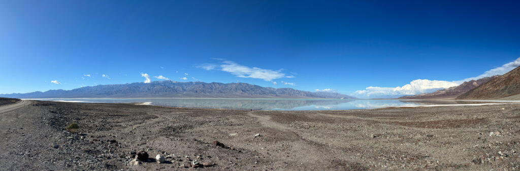
At the edge of Lake Manly, Winter 2024
Tropical Storm Hilary dropped 2.2 inches on Death Valley National Park (DVNP) on August 20, 2023, an all time record, more than the park normally gets in a year. That was the amount at the official weather station at Furnace Creek, but there was more elsewhere, as much as 6 inches at other gauging stations. The rain flowed to the bottom of the valley, Badwater Basin. Damage to roads closed the park for almost 2 months while repairs were made. The basin floor is actually pretty water-logged, with salty brine a few inches below the surface even when it looks dry in the full heat of summer. So rather than soaking in, a bit of Lake Manly was refilled, at a depth of perhaps a foot or less. When full, the lake has been 600 feet deep. We made a quick trip to DVNP on January 2-5, 2024 to see the lake and other effects of the flood. Many parts of the park were still closed. All the photos and videos in this article were taken with my iPhone 14 Pro Max. The title image was assembled from 5 photos using Photoshop. Right clicking on an image should give you the option to open it in a new window or tab on your browser for even more detail.
This followed the August 5, 2022 “unprecedented rain” event, which also closed the park, but only briefly. We visited the park the following June and saw considerable damage from that rain, not to mention the incredible surge in deerfly and horsefly populations (Attack of the Flies). That rain also left some water in Badwater Basin, although not an easily discernible lake. Given that the 1.7 inch rain in 2022 was called a 1000-year event, this makes one wonder if it’s possible Lake Manly could start to truly refill, as it has many times before in the past 3 million years.
We’ve been to DVNP many times. The quickest route from Tucson is to skirt Phoenix on the south and west, take highway 93 north to Las Vegas, past the south side of Vegas, over the mountain pass to Pahrump, take Bell Vista Road to Death Valley Junction, then over the pass to Furnace Creek. Highway 93 is a mixture of two lane and divided highway sections. It’s been ranked as the most dangerous highway in the country in 2018 by Value Penguin. I’ve been stuck for hours while an accident cleared a few years back. On the two lane sections, endless lines of vehicles hurtle past each other, sometimes far above the posted speed limit of 65. It’s a bracing experience. This time, we were as far as Wickenburg when the Phoenix NPR station said 93 was closed. I checked Apple Maps. It sent us on a detour around the accident via US 89 and Bagdad Road, which intersects 93 north of the closure. Closed at the accident, and at Interstate 40 to the north, 93 was eerily free of vehicles in both directions. We reached Furnace Creek Ranch check-in after 7 PM California time, 2 hours later than we had hoped. There was a very long line snaking around the entire interior of the office. We did manage to have dinner at the Last Kind Words Saloon before they closed at 9 PM.
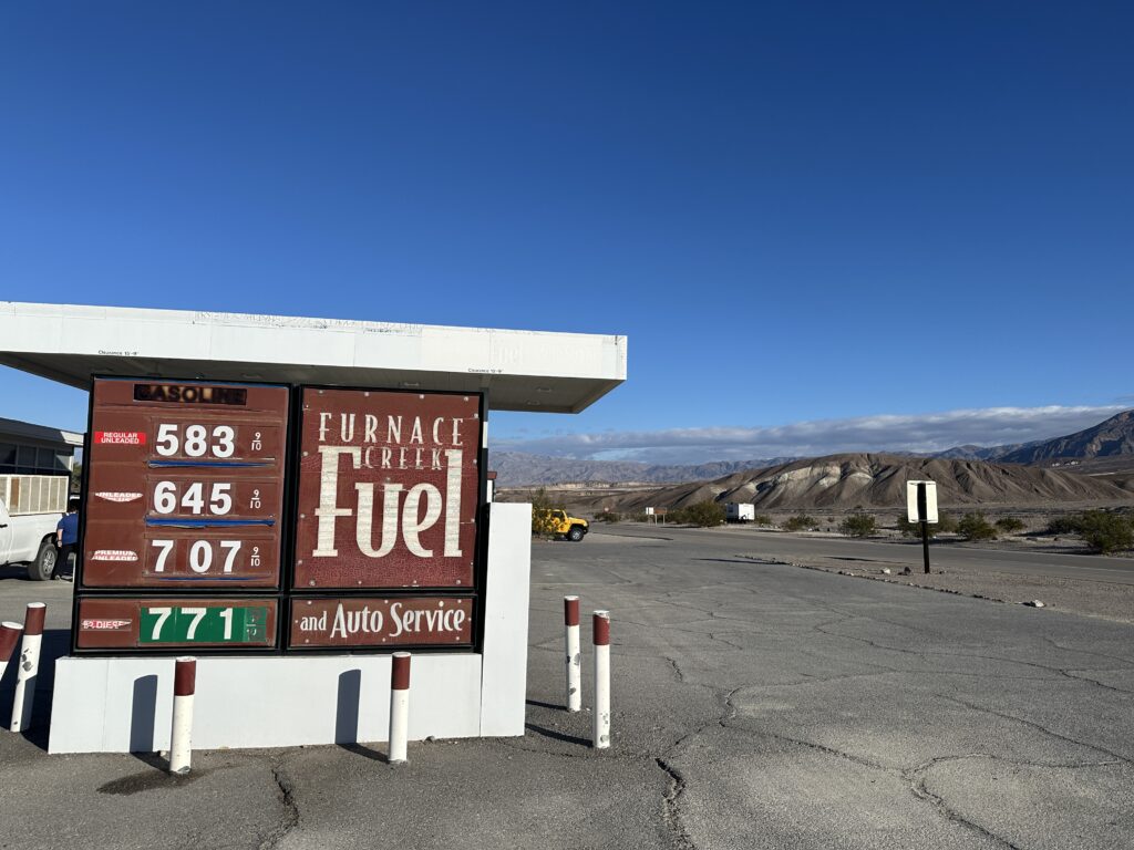
After breakfast at the 1849 Buffet, we walked north to the DVNP Visitors Center. Furnace Creek Fuel had the highest prices I’ve seen there so far.
We asked a ranger at the Visitors Center what we might look at besides Lake Manly and Salt Creek to see flood damage. She agreed the lake and creek were good choices. She suggested Titus Canyon, which had a one-way road from outside the valley near Beatty before the flood. EnviroSports holds a marathon on that route, which we’ve done a couple of times many years ago. The ranger had heard of the run. She asked us to let the park rangers know if we saw pupfish at Salt Creek.
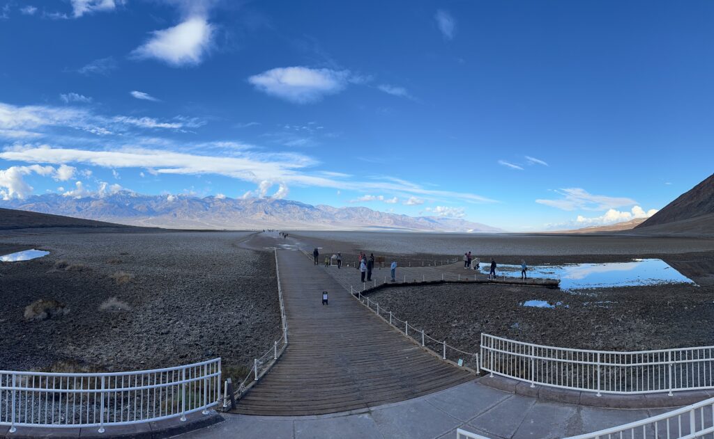
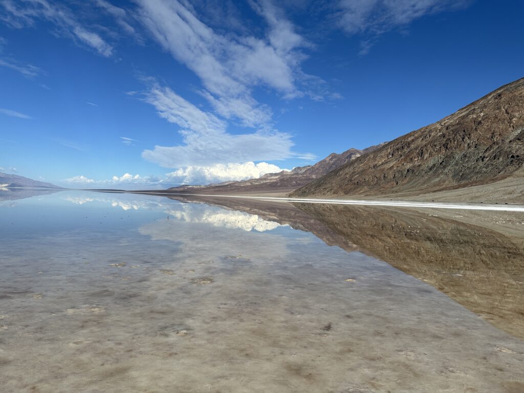
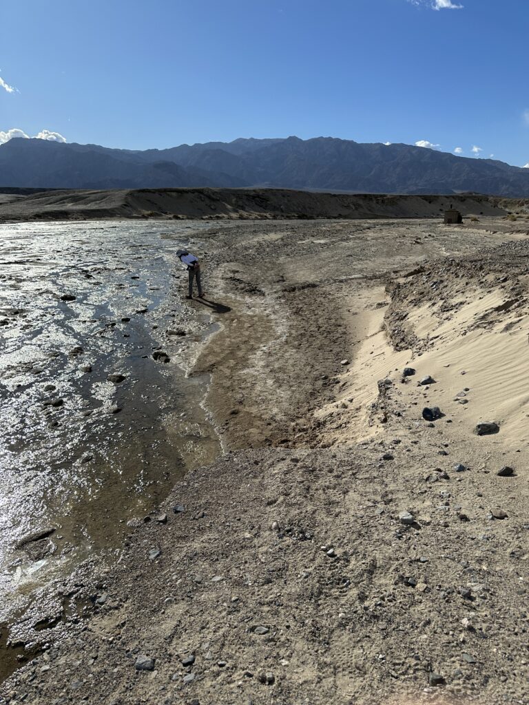
As we drove south to Badwater Basin, the lake appeared. There was actually some water in the Basin last summer, but this was a real lake with a mirror surface and a shoreline. At Badwater, people could walk about 0.4 miles to the shoreline. Here’s what we saw.
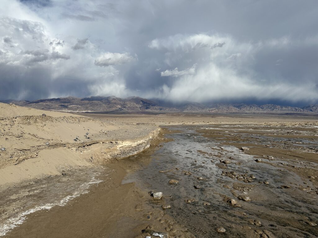
Looking north (below), here’s the valley and lake with clouds from a storm moving in.
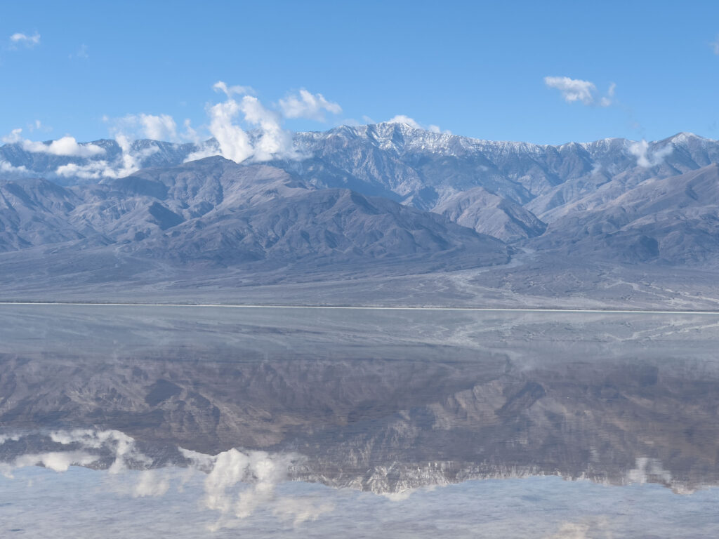
Below is a view of the Panamint Mountains, with a reflection in the lake. The highest snow-covered peak is Telescope Peak, elevation 11,331 feet. We’ve been up it a couple of times. There is a stand of Bristlecone Pines near the top.
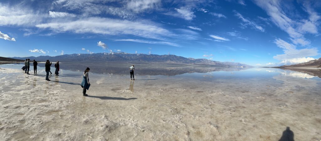
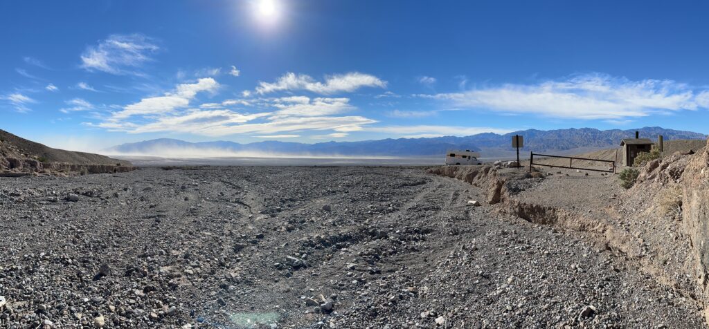
After walking out and back, we drove south a few miles to see the extent of the lake, and perhaps the Amargosa River channel. We didn’t see much, so turned around. We stopped a bit before the Badwater Basin viewing area where the lake had a definite shoreline and walked down to it. That’s the location of the title image at the top of the article. Below is another north view that shows the rapidly changing cloudscape and the snow-like salt crust of the lake margin.

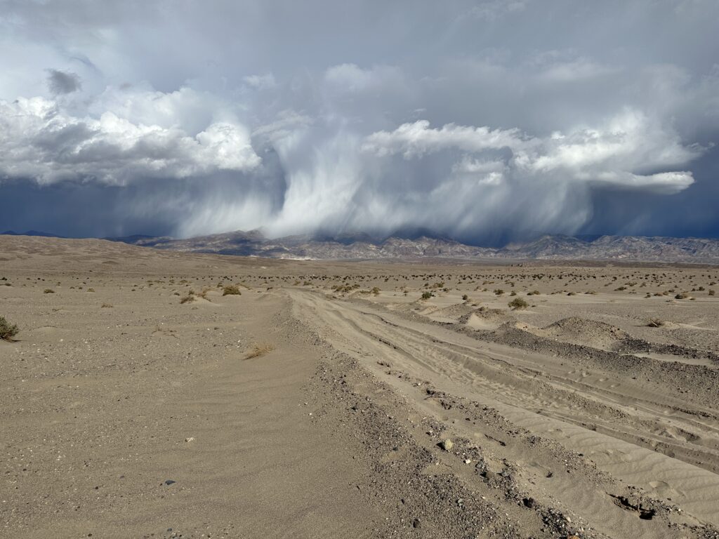
From Badwater, we drove north to the turnoff for Salt Creek. That road has been closed for several years now. We parked, then walked the mile to the actual creek. We kept an eye behind us on the ferocious looking storm in the Funeral Mountains to the east, ready to scurry back to the RAV4 if it came closer.
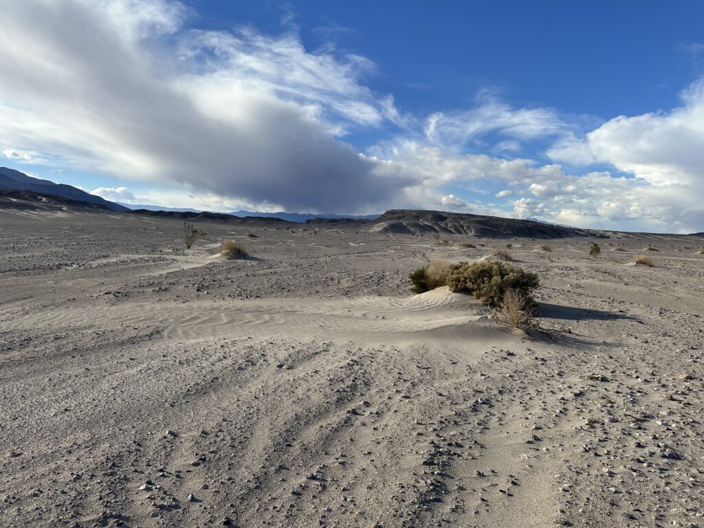
You should notice we’re paralleling the road, which has been turning into a mini-dune field in some sections. It was noticeably sandier than summer 2023. The road ended abruptly in a drop off where the parking lot used to be. Below is photo from the previous summer and a photo from January 3rd, 2024.
In both photos, you can see the remnants of the restroom in the background. In the summer photo, the road more or less continues to the parking area near the restroom. In the winter photo, the road ends in a drop-off, replaced by the creekbed. The former parking area is now a flood debris field.
The photo below shows the road edge, with the storm in the Funeral Mountains in the background.
We turned our attention to finding pupfish. They seem to weather floods remarkably well. We quickly spotted a few individuals.
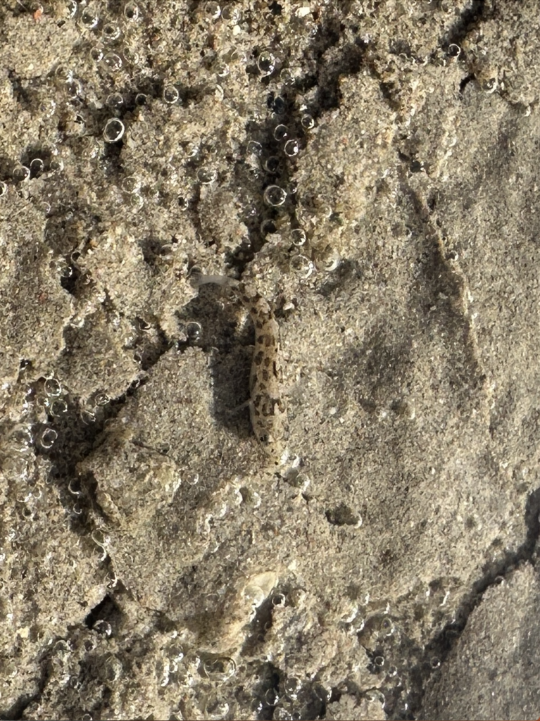
Walking upstream, we found more flood damage, plus actual schools of pupfish. They seemed aware of us and sped away when we got close. Here’s a video of an area that was once vegetated channels and elevated boardwalk. One small section of the boardwalk is visible at the end of video.
YouTube turned the pupfish video into a Short that replays over and over. My wife commented the school of fish looked like a veil on the water.
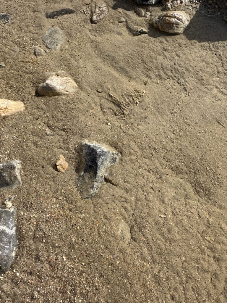
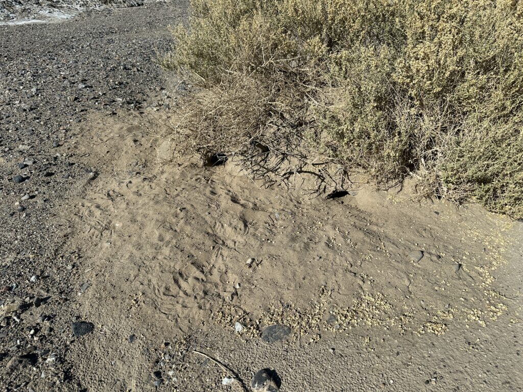
On our way out we noticed the happy looking creosote bush we had taken branches from last summer to beat back the horseflies. All the creosote in DVNP looked very happy. At the base of a different kind of bush, we saw several rodent burrows, with footprints. We were impressed that they can survive in a very demanding environment.
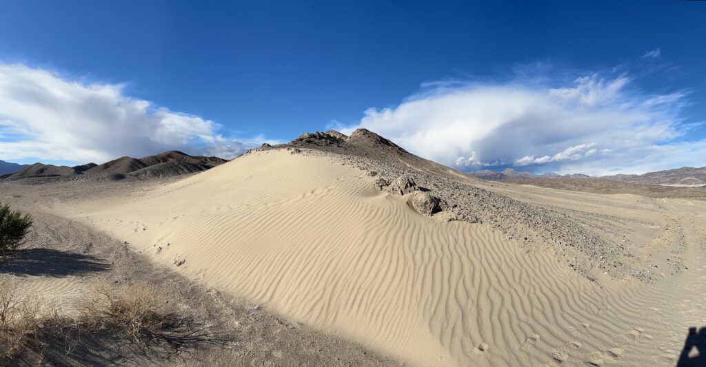
The sand dunes were striking as well.
We walked back to the RAV4 and drove to our room at Furnace Creek. The weather appeared to be clearing, but to our surprise, a storm hit and knocked out power to the valley for at least 45 minutes. The power was restored before we walked up to the Last Kind Words Saloon for dinner, but they said they were not going to open that evening. They sent us to the Inn at Death Valley Dining Room up the hill. There we found an overwhelmed Dining Room manager. We told him the Saloon staff had assured us of dinner there, which dismayed him. As he tried to accommodate the onslaught of displaced patrons, we found a seat at the bar nearby. The amazing bartender, Joe, told us he could put everyone at the bar first in line for actual food. Everyone sitting at the bar stayed put and got actual food, watching Joe’s incredible skill mixing drinks at breakneck pace. I had what was possibly the best pork chop I’ve ever eaten.
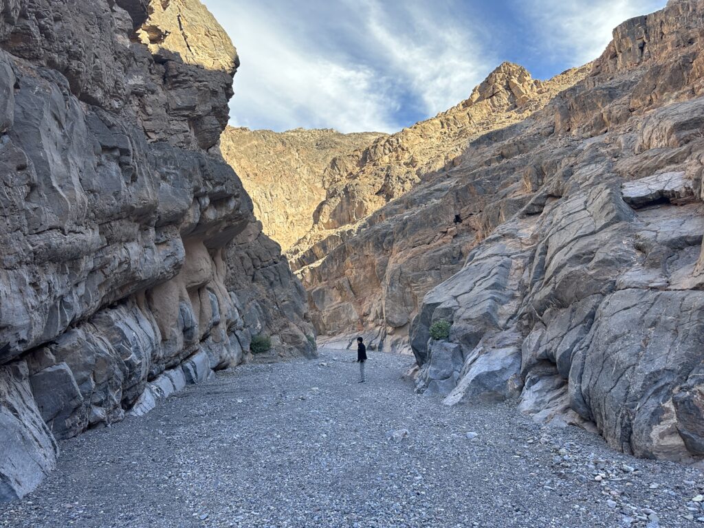
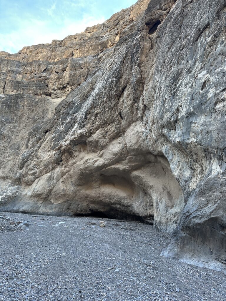
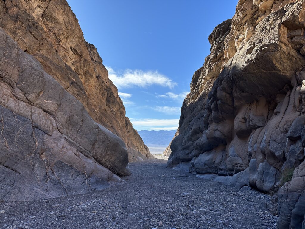
Next morning we took it easier. After a breakfast at the 1849, we went back to the room where my wife did a bit of work for the classes she’s teaching this spring. The Ranch used to have horrible Internet, but after their renovation it’s been excellent. In the late morning, we headed north toward Titus Canyon. At the turnoff, the three mile road to the canyon mouth was in decent shape, although best driven with a higher clearance vehicle, not a sedan. Post-flood, the road now ends in an abrupt drop-off just past the parking area and gate.
We walked somewhat over a mile up the canyon, turning back because my wife wasn’t feeling great and the canyon was a bit closed in for her taste. There was no trace of a road.
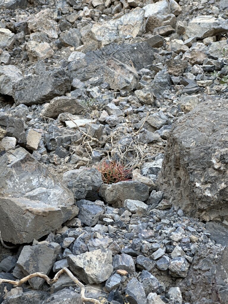
We came across a small cactus lying in the stream bed, its roots sheared away but otherwise healthy. It was probably a California barrel cactus, Ferocactus cylindraceus. We planted it on a level spot on a slope nearby and gave it a bit of water. Maybe we’ll return in a few years to see if it survived. Here’s where we left it.
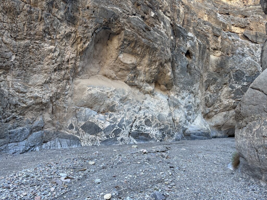
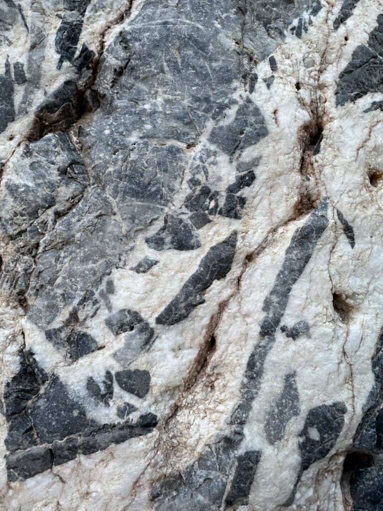
On the return, patterns of gray rock with white veins and inclusions caught my eye. The USGS says it’s limestone breccia. They took a photo of the same formation below over 20 years ago, with a person sitting in front for scale.
From Titus Canyon, we went south, then west past Stovepipe Wells, looking for interesting side roads. They were closed due to flood damage. We saw a number of patches on the main road, repairs since August. Back at Stovepipe Wells, they only had Regular gas, and it was only $4.54/gallon, so I filled up the RAV4’s tank. Back at our room, we finally had an uneventful evening, with a pleasant dinner at the Last Kind Words Saloon.
The next morning, Friday January 5th, 2024, we got an early start for Tucson. Going up Highway 190 through Furnace Creek Canyon, we could see large areas where missing roadway had been replaced. On Highway 93, we saw one accident on the other side of a divided section of the highway. A truck was overturned, perhaps having fallen from our side, which was higher ground. On the 2 lane sections, I watched the oncoming traffic carefully while also considering the terrain on the right side of the road in case I needed to make emergency maneuvers. We reached home without event. Good chance we’ll return in the summer, maybe not in horsefly season.