Attack of the Flies
Being chased by clouds of hungry female horseflies is new, something I’ve never experienced in over 50 years of exploration of the natural world. It happened in Death Valley National Park (DVNP), a place I’ve been visiting for over 30 years. DVNP is huge, the largest national park in the lower 48 states. My wife Pam and I keep finding new places to explore there and nearby, or new ways to explore places we’ve been to before. We’ve run marathons and ridden 100 mile bike rides there. Despite all that, we had never, ever had encounters like the ones on our most recent trip in June of 2023. At the south end of the valley, we were besieged by deer flies. They seemed to especially like the backs of our legs, although they would land and bite anywhere. They were unpleasant, but didn’t stop our hiking and photography. The following day, when we went to visit the Salt Creek pupfish in the upper part of the valley, we (mostly me…) were attacked by horseflies, which were much worse. We managed to take a few photos and videos, then had to retreat to our RAV4. Horseflies followed us the entire mile and a quarter back, then flew around the vehicle as we got in and left.
It’s about 540 miles from our house in Tucson, Arizona, to Furnace Creek Ranch, California, now part of what Xanterra calls The Oasis at Death Valley. That’s a doable day’s drive if we keep moving along, mostly on 4 lane highways. We have to get across the Tucson metropolitan area since we live about as far from Interstate 10 as is possible in the northeast corner of the Tucson Basin, but then we can use highways that skirt the south and west sides of Phoenix and Las Vegas. Most of the drive is pretty scenic. If we can line up rooms at the Ranch, we can hop in our vehicle, then zip north and west. Since 2020 we’ve been using a Toyota RAV4 Hybrid, which has better ground clearance and undercarriage protection than the Prii we had been using since 2009. That allows us to explore places more off the beaten track, like our trip to The Racetrack in 2022. Around Tucson, the RAV4 has been getting over 46 mpg lately. It averaged 39.2 mpg on the trip, which reflects the vehicle’s computer having to run the engine more to sustain continuous speeds on highways.
A 4 day window of opportunity presented itself for June 11-14 2023 on fairly short notice. To my surprise, there were plenty of available rooms. As I wrote this, I checked the availability for rest of the summer. I found no booked-full dates, which is unusual. In years past, the Ranch has tended to be full of mostly European tourists throughout the summer.
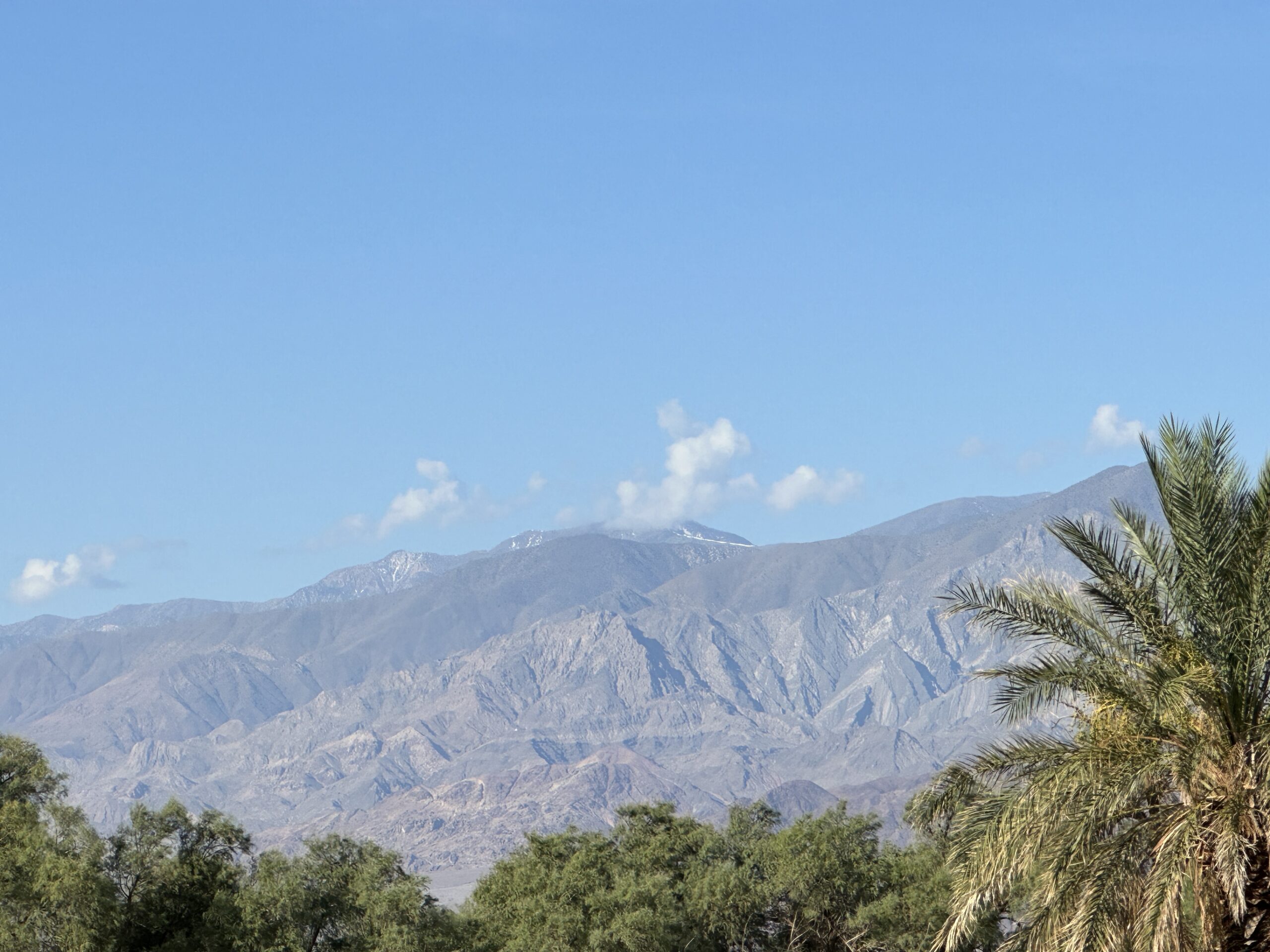
The trip went well. We got off earlier than we often do so arriving a bit earlier, shortly after 6 PM. Since Arizona doesn’t do Daylight Savings Time, we’re on the same time as California in the summers. Instead of the usual line of people checking in at the Ranch, there was a single person. We were congratulating ourselves on an efficient transit and early pleasant evening, when we found the sink in our room was stopped up. That necessitated a quick walk the 0.3 miles to the office, new room keys, and a transfer to another room, fortunately just down the hall near the west end of the second floor. We got unpacked a bit, washed up, and trekked the 0.3 miles again to the Last Kind Words Saloon for dinner, which was quick and pleasant. Here’s the view from the second story stair landing at our hotel the following morning, looking west toward the Panamint Mountains.
When you hover your cursor over an image in this article, you zoom in. Moving the cursor moves what’s in the zoom window. You can also right click on any photo, select Open Image in New Window (or Tab in Firefox), and see a larger that can click for the full-size.
Looking southwest, there was still some snow near the top of Telescope Peak, elevation 11,043 feet. We’ve been to the top twice, albeit not for years.
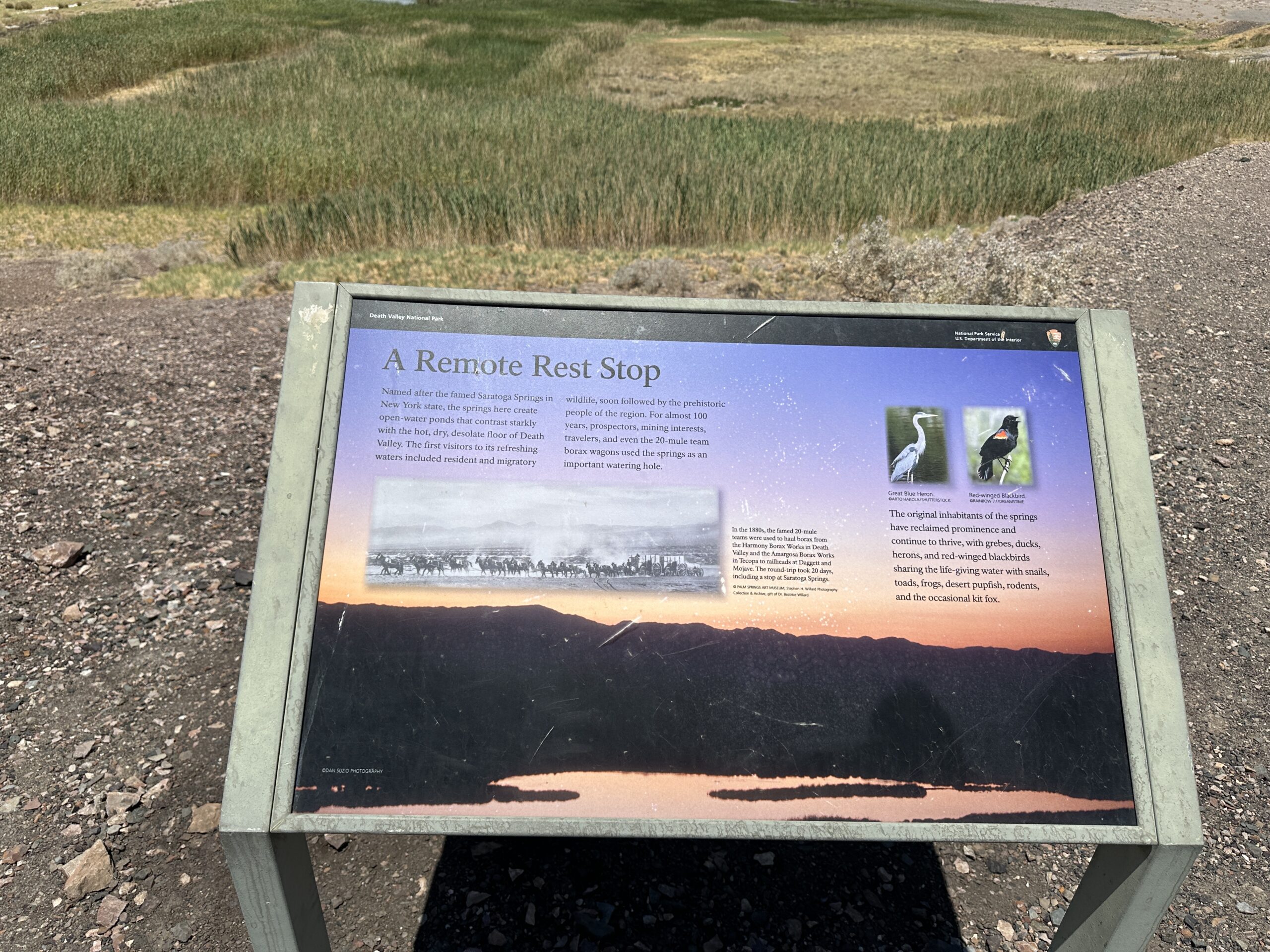
In preparing for the trip, I had searched Google for “death valley insects” in part because I’ve been hanging out with the entomologists at the University of Arizona Insect Collection lately (I have a Ph.D. in Entomology, awarded by UA in 1983). One of the first things that popped up was the Death Valley June beetle (Polyphylla erratica). It was more interesting looking than the species we get in Tucson, but what really caught our attention was that it was found at Saratoga Springs.
Saratoga Springs? We hadn’t heard of one in Death Valley (DV), although we have visited the town and associated springs in New York State when my younger son lived there. Turns out the DV Saratoga Springs is probably named after the New York ones. We were interested and figured out how to reach it, with only a bit of trepidation about visiting a remote spot at the south end of the bottom of DV in the summer. Actually, while we wert there it was rather cool for DV, with predicted highs only about 98 on the day we planned to visit the springs.
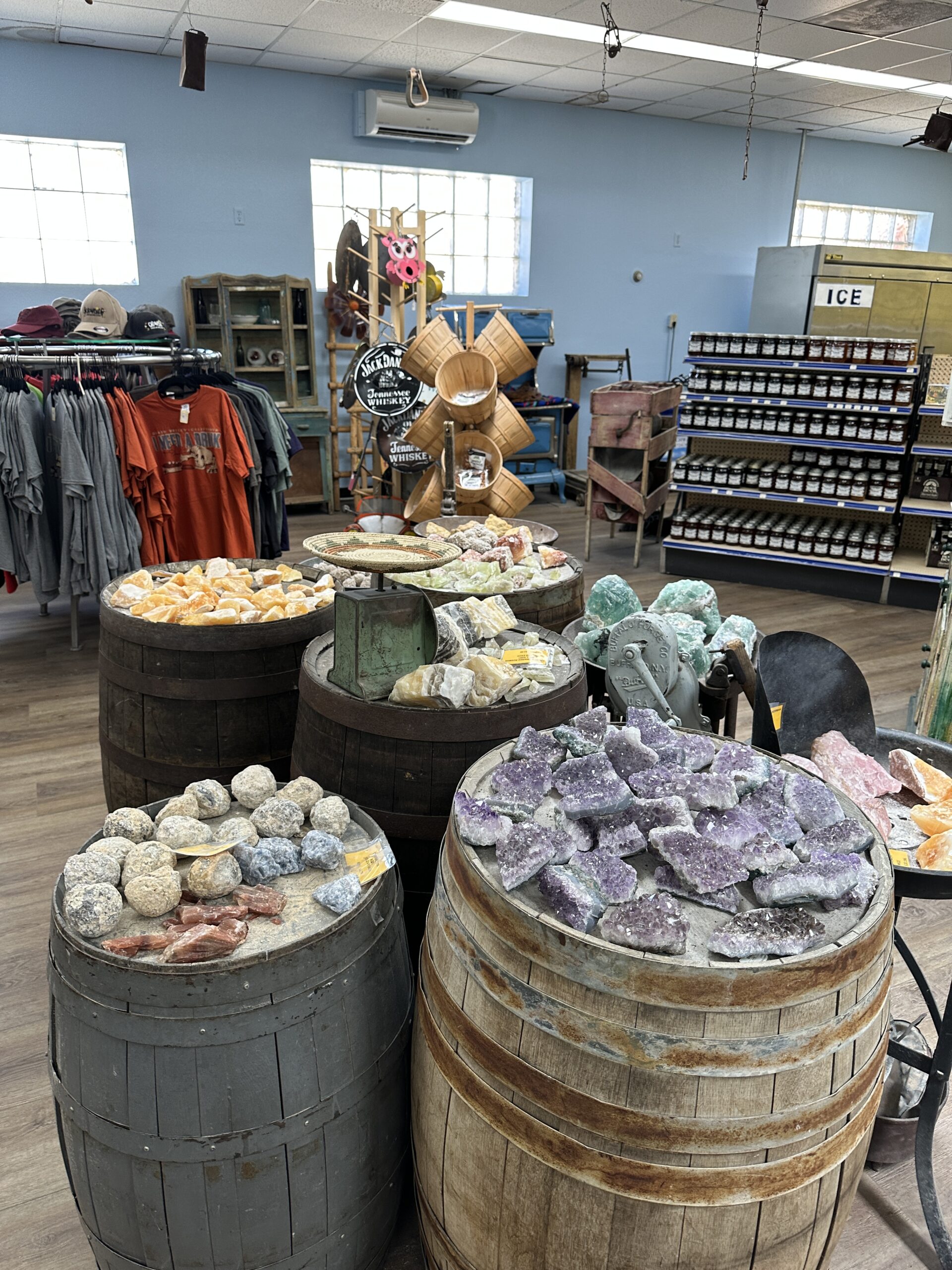
We slept in, did a bit of exercise, had a nice breakfast, and set out on the road south past Badwater and Mormon Point, then east over Jubilee and Salsberry Passes to Shoshone, outside the park. Around Badwater, we found machines clearing debris where the road had flooded recently, leaving several deep puddles as well as the debris. We saw the lake bottom to our west had some water as well. In Shoshone we stopped at the Chas. Brown Co. Market. We were surprised by the array of things they stocked, including a lot of rocks. We’ve been to Shoshone before, hiking in the area and meeting the local pupfish.
This time we went south on Highway 127, past the Dumont Dunes to the Saratoga Springs turnoff. We had checked at the Furnace Creek Visitors Center and been told the road would be drivable if there hadn’t been recent flood damage. The first ~5 miles was outside the park on a pretty soft, loose roadway that was actually below ground level with berms on either side. Maybe not a good idea in a sedan. The RAV4 had no trouble and didn’t bog down anywhere. At the junction with Harry Wade Road, which continued up the valley, we turned north on Saratoga Springs Road. It was in better shape and re-entered the park.
After another ~5 miles, there was a parking area. The road continued to the old mine sites in the mountains, but it’s blocked for vehicles at the north end of the parking area.
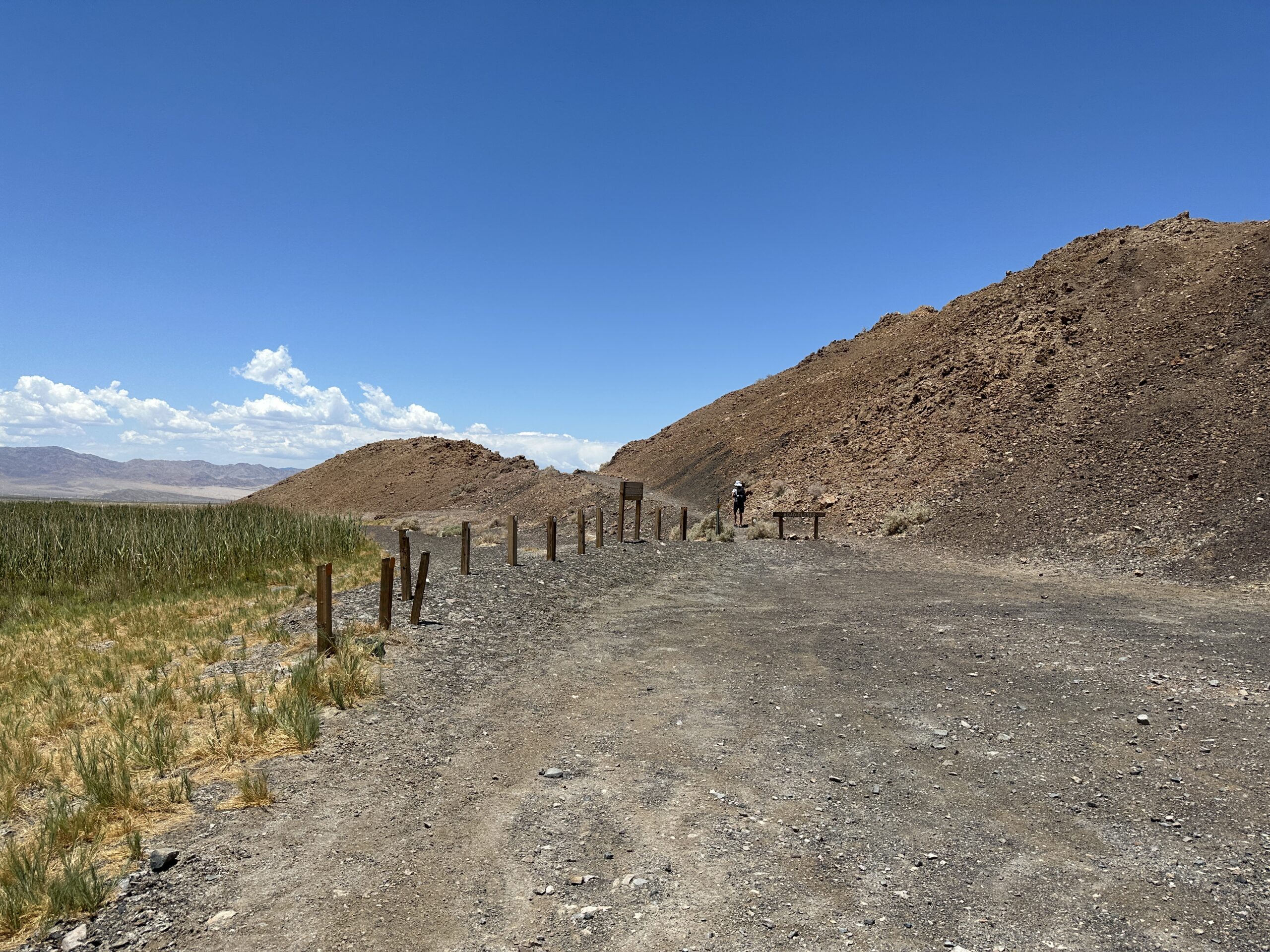
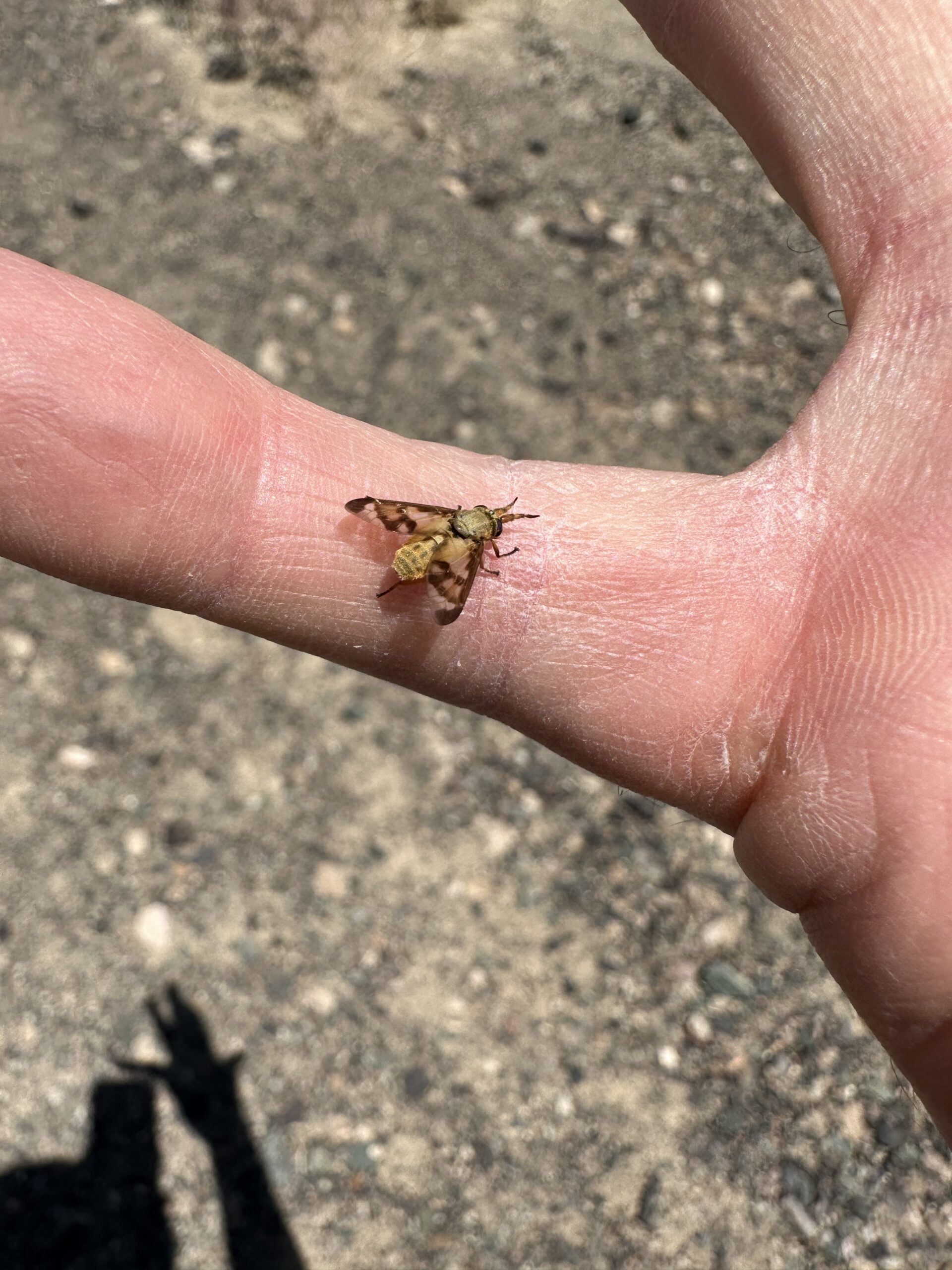
We walked up that road, across the valley with the springs on our left to the next ridge line and back, taking photos along the way. During the entire hike we were beset by deer flies, which seemed to especially like the backs of our legs. We both let deer flies stay on our hands long enough for me to get photos. Here’s my hand and a biting fly.
There were some large black insects zipping around, which I vaguely thought might be wasps, like the large one that had landed on my hand when we had stopped at the turnoff from 127. Little did we know….
We retraced our route to Furnace Creek Ranch, with a slight detour along the way at a communications facility to see what it was. We got back with plenty of time to clean up and have an early dinner at the Last Kind Words. We decided we would go down to Badwater the next morning, then come back up to the Visitors Center to see if we were allowed to hike into Salt Creek, since the access road was closed to vehicles now.
When we got to Badwater, Pam saw a berm beside the road that would make a good place to set up her tripod to photograph the stark wall of the Black Mountains to the east, with Dante’s View at the top at 5,575 feet above the basin. I wanted to walk toward the middle of the basin, so we agreed to met back near the RAV4 after about 45 minutes.
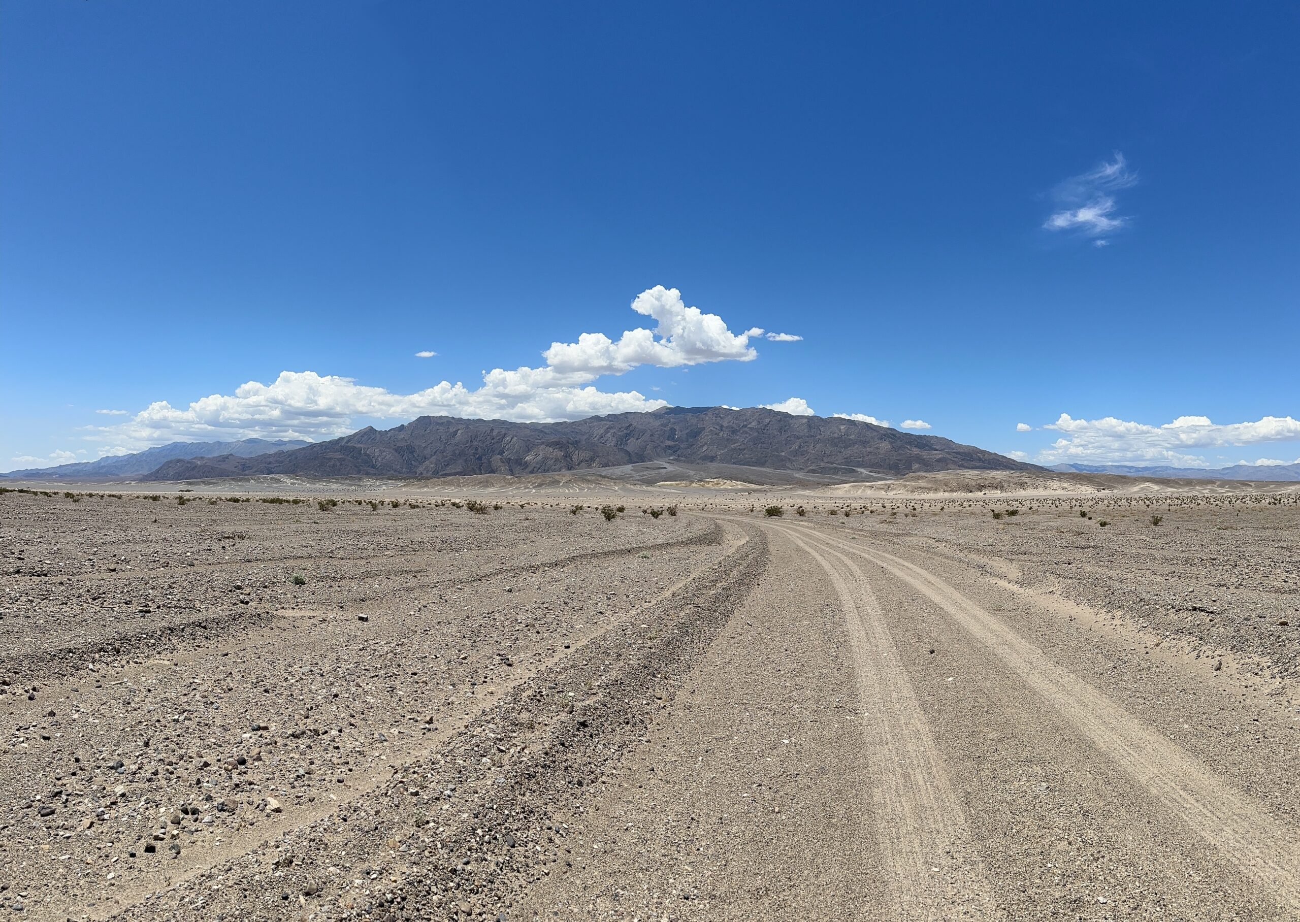
I started walking quickly, wanting to get as far as possible before turning. The surface was as expected, polygons of salty sediment with a beaten path going west.
People coming back said there was water, which we hadn’t encountered before in our treks toward the basin’s center. I assumed puddles, but found after about 0.8 miles that I would need to wade through standing water if I wanted to continue. For a brief period, Lake Manly was starting to refill. That happens occasionally, but doesn’t last. I turned around and walked back.

No Pam at the RAV4, but I saw a figure on the berm a couple of hundred yards north of the parking area. I went toward her, and climbed up to the berm top as she headed back.
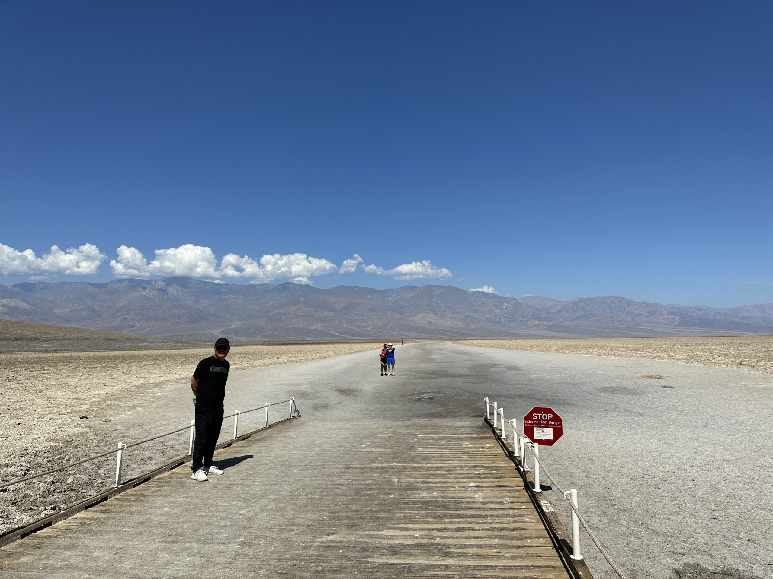
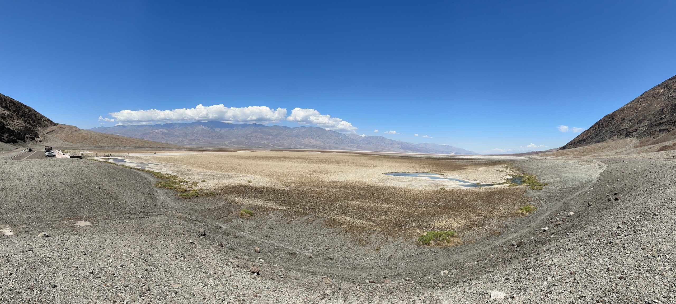
Badwater Basin is named for the pool of undrinkable water next to the parking area. There’s a boardwalk the Park Service would like you to stay on.
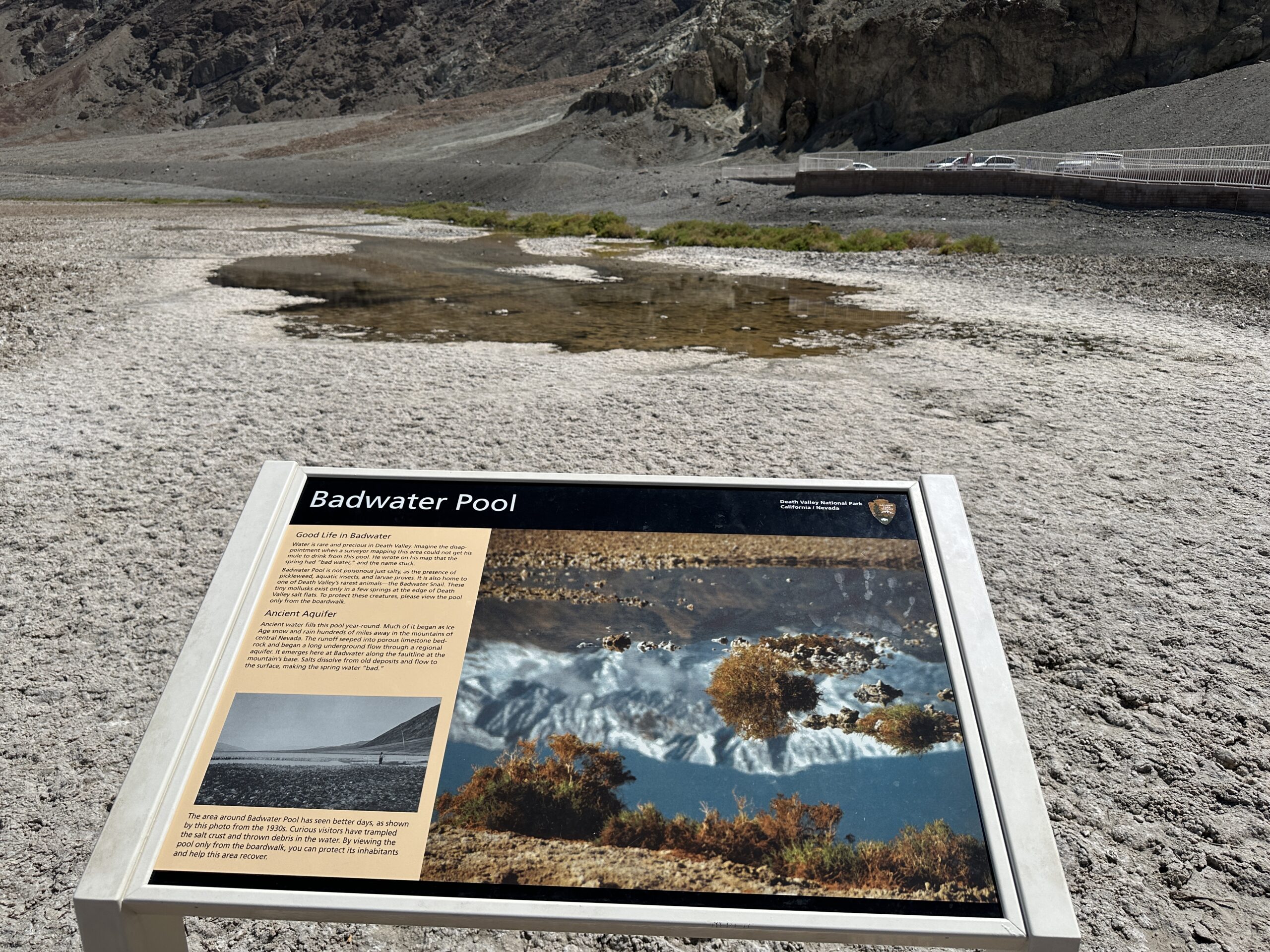
From the berm, we could see a second pool, not visible from the parking area. Here’s a panorama of the two pools.
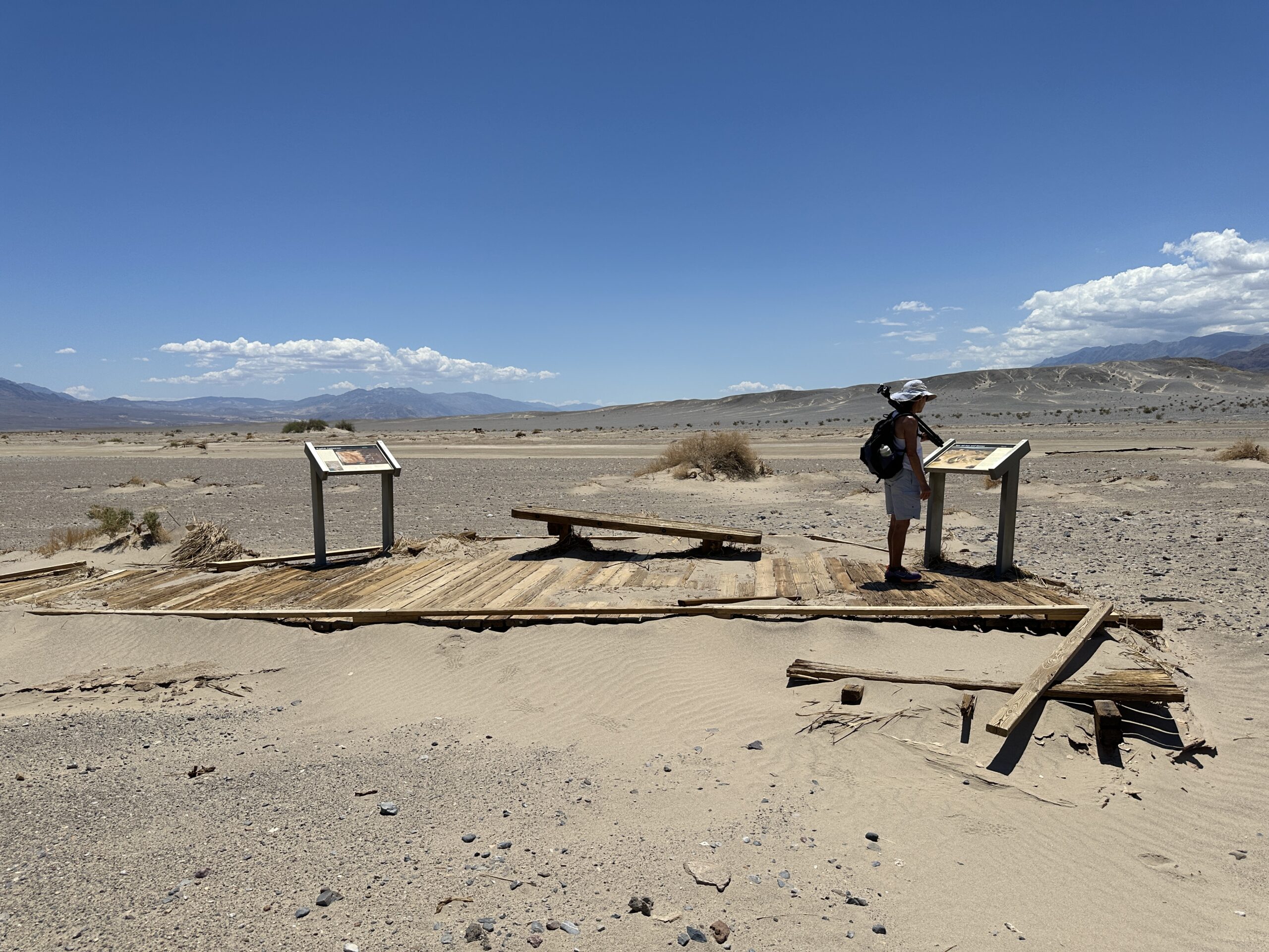
We made our way to the Visitor’s Center and asked if we could hike into Salt Creek. The road and the parking area were closed after the boardwalk had washed away and the restroom was damaged in the 2022 massive floods. 1.7 inches of rain fell at Furnace Creek weather station, the most ever recorded there. More than that probably came down elsewhere. The ranger said sure, but be mindful of the heat. Also, stay out of the creek. Since it was running about Tucson temperatures, not the 120s we’ve encountered on visits in July and August, we drove to the closed gate and parked. We took more water than we would need, and started the supposedly 1.5 mile trek to the parking lot and former terminus of the boardwalk. That’s Tucki Mountain in the background, which the 49ers had to cross to escape DV.
A bit over a mile in we encountered a piece of the boardwalk which had been swept down stream with the pupfish interpretive display still attached.
Continuing on we reached the parking area with a damaged restroom on the right and the creek flowing well on the left.
Salt Creek was teeming with Salt Creek pupfish, the most we had ever seen. Pam set up her tripod and camera to take landscape photos while I took photos and videos of mostly pupfish.
Below is one view looking upstream. In the far distance is the Panamint Range on the west side of DV. Closer are are a set of white hills. There was a trail from the boardwalk that led over those hills to the series of pools from the springs that feed the creek.
Here’s a view of those pools taken on Dec. 29th, 2015.
The pupfish definitely saw us. When we got close to the creek, they swam away quickly. Here’s a video I made following a school.
Below is the best photo that shows individual pupfish. As with the other photos, float the cursor over the photo to zoom in.
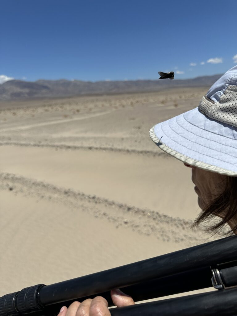
Suddenly, I started to feel something trying to bite my back. Many somethings, big, black, and moving fast. I surmised horseflies, which we had never encountered before at Salt Creek or anywhere else in DV. I walked toward Pam, who said I was in a cloud of insects. They started to attack her as well, albeit not as ferociously. We hastily retreated, stopping at large creosote bush to break off a branch that I could use like a horse’s tail to sweep away horseflies. They followed us.
I noticed they sometimes lit on Pam’s hat, so I tried to get photos, one of which is the featured image above. Here are two more.
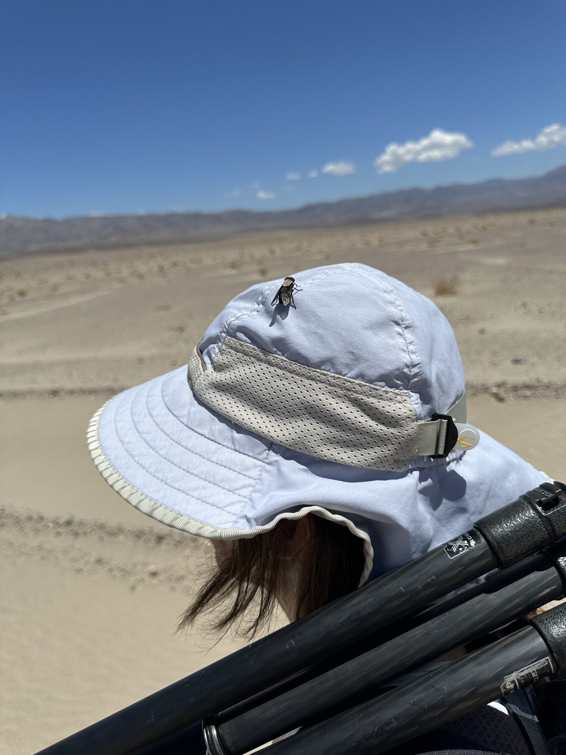
The horseflies followed us to the RAV4 and buzzed about. Fortunately, none got inside. I posted the photos in iNaturalist, which identified them as Tabanus punctifer, the Western Black Horsefly. We thought the encounter was pretty interesting, allowing for some discomfort.
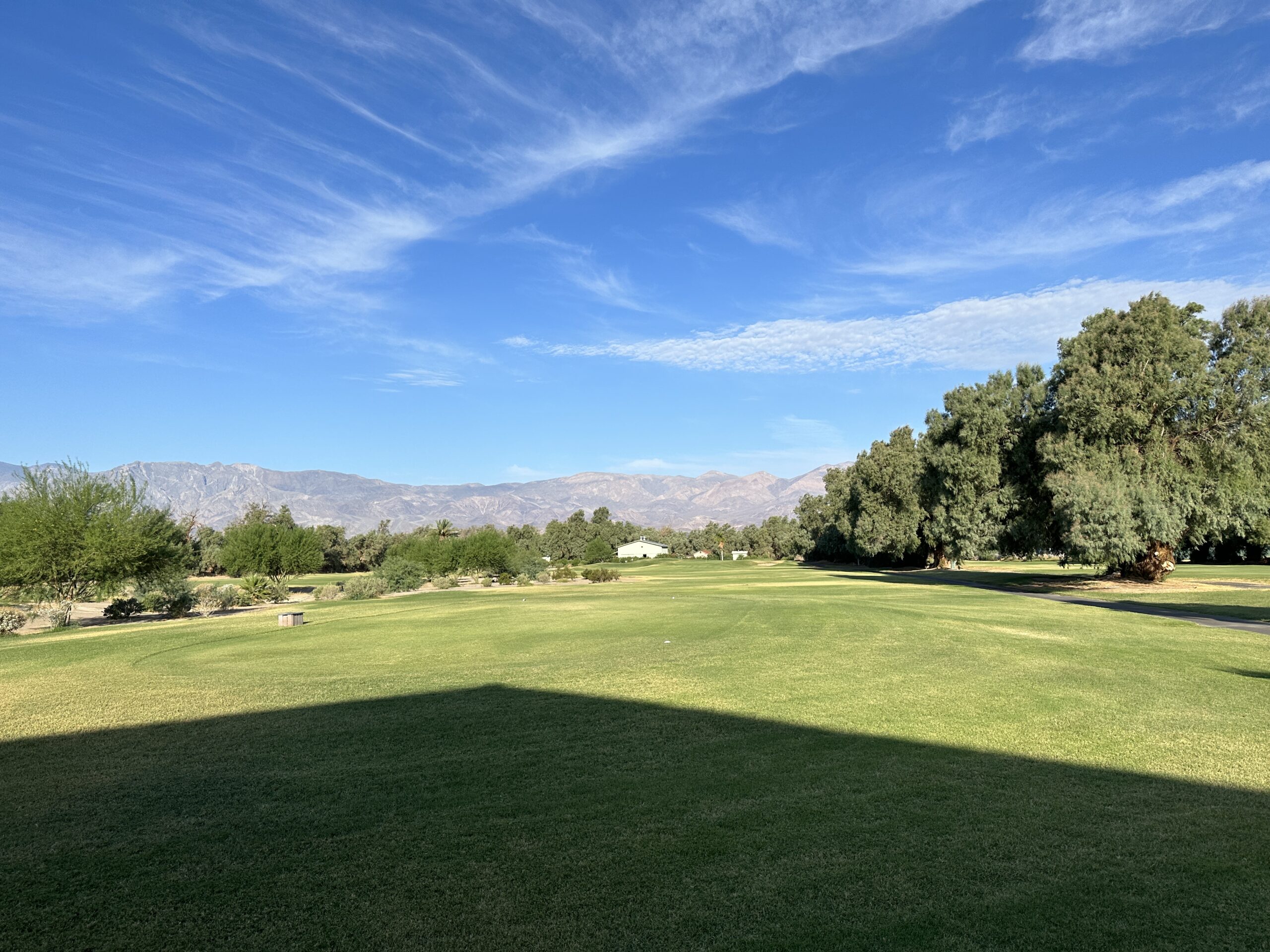
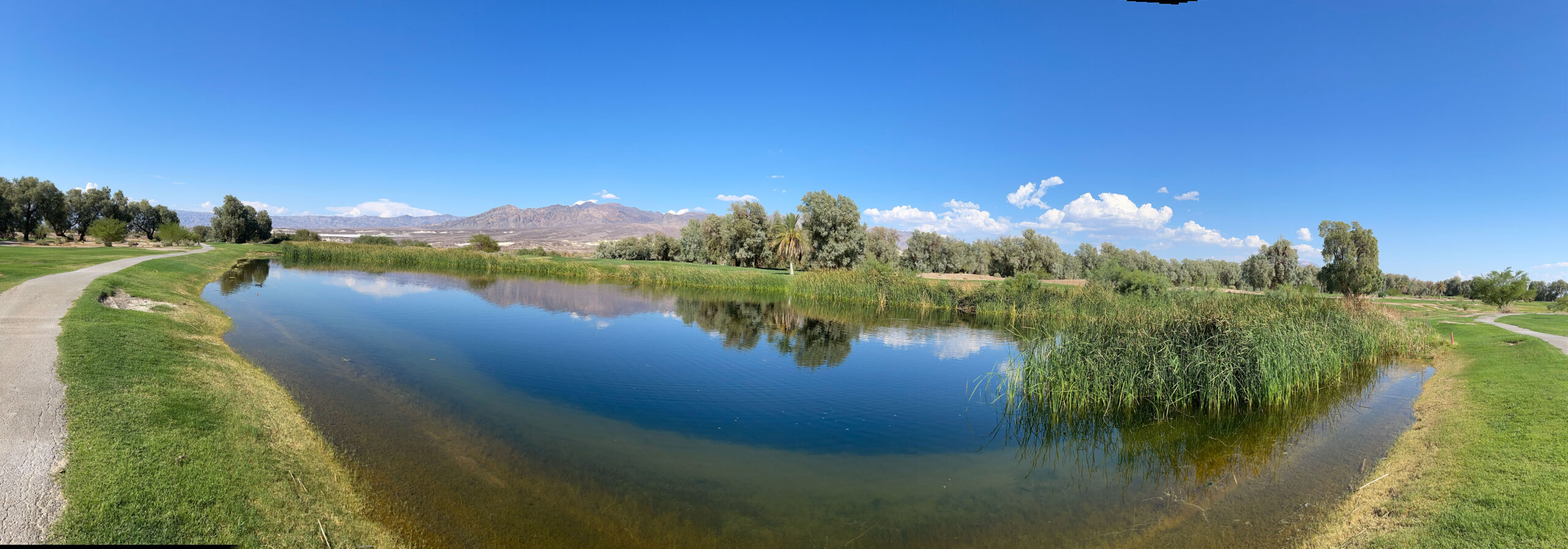
We went back to Furnace Creek, where I took a nap and Pam went to check the two ponds on the golf course that are bird refuges at certain times of the year. Here’s a photo from our 2021 DV visit.
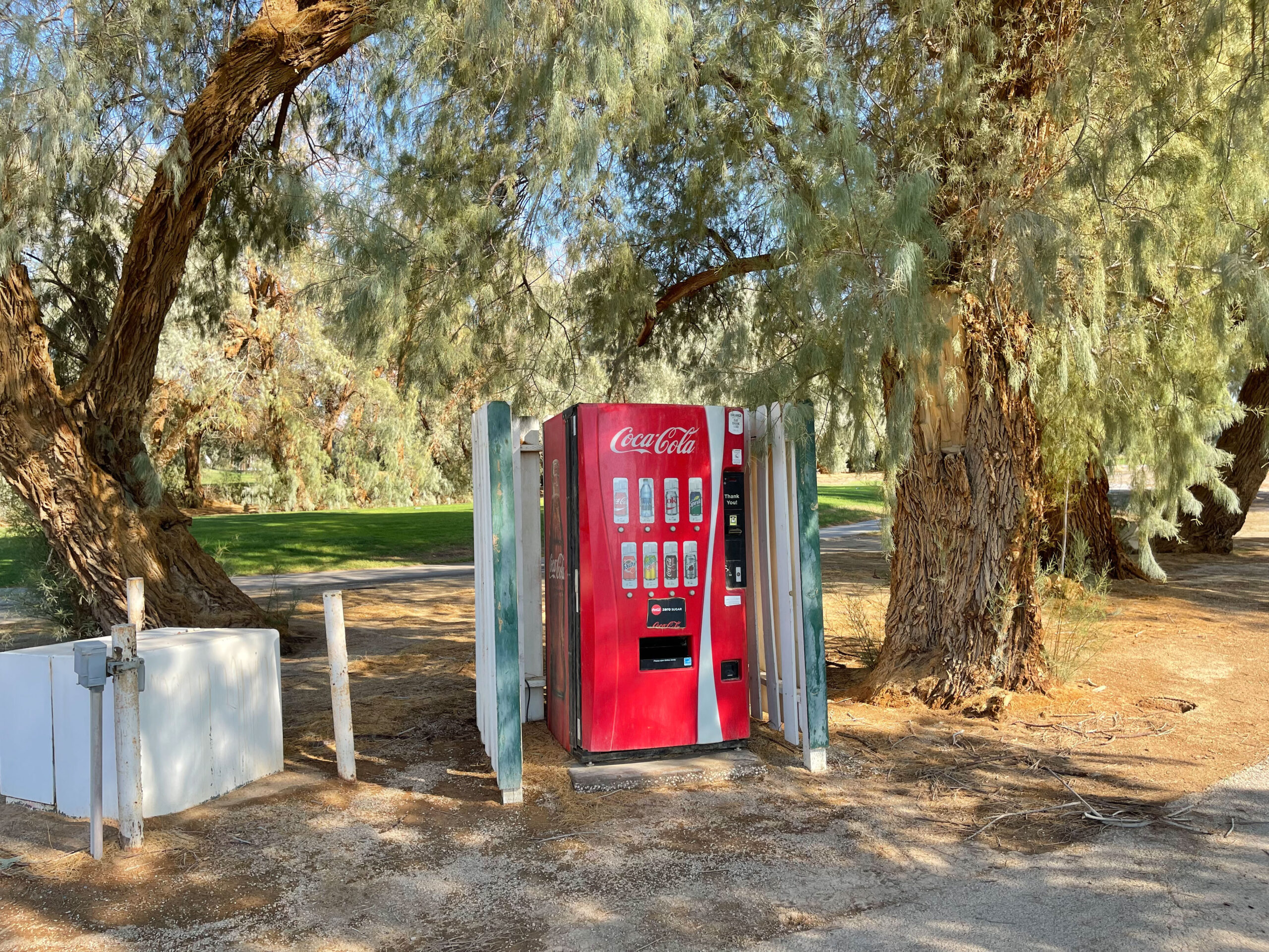
She also noticed that the coke machine near the ponds was turned on. It hadn’t been when we took this photo in 2021. Placed at least 190 feet below sea level, it may be the lowest coke machine in the world.
Then she went for a dip in the Ranch pool. Furnace Creek Inn and Ranch are quite lush, in truth an oasis. A large aquifer feeds two water systems for the resort, visitors center, and campgrounds. The Park Service and Xanterra cooperate to manage these systems.
Before another nice dinner at the Last Kind Words, we went to the General Store and the Gift Shoppe for gifts for people, most notably dates. One of the striking features at Furnace Creek Ranch is the large date palm grove, now with trees that are too big to harvest dates from easily. When I started going to DV, there was a small stand at the edge of the grove that sold Death Valley dates. That’s long gone, and now the General Store stocks dates from nearby China Ranch.
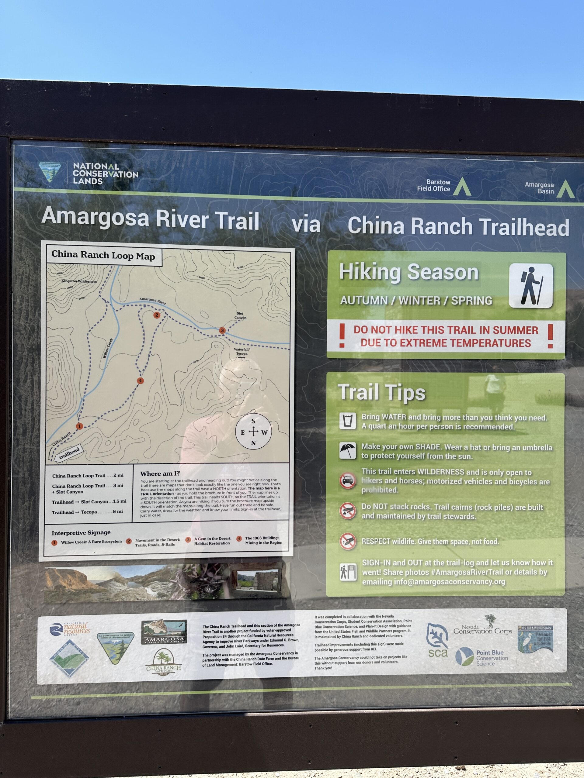
To our surprise, the General Store was out of dates. We decided to go to the source. The next morning, we took the route home east and south through Tecopa, then on a side road down China Ranch Canyon. We parked in the lot next to the gift shop, then walked down to the China Ranch Trailhead for the Amargosa River Trail system. Horseflies buzzed around us. We want to return and explore this trail system, albeit not in horsefly season.
At the gift shop, we purchased up 10 one pound packages of dates, plus a couple of interesting rocks. Featured prominently on the wall behind the cashier window was a big picture of a horsefly labelled Tabanus punctifer. David the cashier and I discussed horseflies. David was the shipping person and remembered a large order I had placed for dates as Christmas gifts a few years earlier. From there Pam and I continued to Tucson.
In some ways, this was one of our more interesting visits to the Death Valley region. We hadn’t known about Saratoga Springs. The flood damage to Salt Creek, combined with the stream full of pupfish was fascinating. We don’t know if deer flies and horseflies are a normal feature of Saratoga Springs, but they certainly were new for us at Salt Creek. When I posted the deer fly photos to iNaturalist, it didn’t know what they were, but I decided they belong to genus Chrysops. Back in Tucson, I went to the UA Insect Collection, where Collection Manager Gene Hall showed me the trays of Chrysops. They were clearly what we had seen and been bitten by. The folks at China Ranch were quite familiar with the horseflies. David said as it got hotter in early summer, they got more active. The adults only live about a month, so by late summer, they’re probably gone. For both deer and horse flies, it’s the females doing the biting to get blood to provision the eggs they want to lay. For us (and other mammals they bite), it’s painful, but it’s crucial for the flies if they are to have offspring. It occurred to me we normally visit in late summer and winter, so may have been dodging the adults. The larvae can take a year to grow before metamorphosing into adults, which makes me wonder if the 2022 rains gave them a boost. I’m going to do some more investigation and update if I learn more.